How Many Visitors Can a Gunungkidul Beach Handle?
Tourism carrying capacity is not a single number for an entire coastline. Research at beaches in Gunungkidul illustrates why estimates must be tied to the activity, usable area, facilities, season, and management capability.
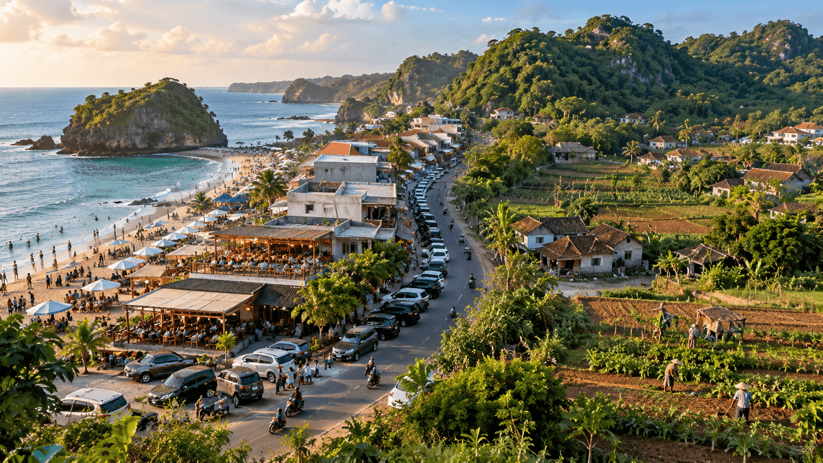
There is no single visitor limit for an entire coastline
A beach can feel crowded before its ecosystem is visibly damaged. Parking may become difficult, public toilets may be overwhelmed, waste collection may fall behind, and emergency vehicles may struggle to reach the shore. These are not identical problems, and they cannot all be solved by choosing one maximum visitor number for all of Gunungkidul.
Tourism carrying capacity is best understood as a site- and activity-specific management tool. It asks what level of use can be accommodated without unacceptable deterioration in environmental conditions, safety, public services, or visitor experience. A useful estimate must state what is being counted, where, when, and under which operating conditions.
The distinction matters in Gunungkidul because its coast includes beaches with different shapes, sizes, access arrangements, water conditions, facilities, local uses, and management systems. A number calculated for one beach cannot be transferred automatically to another.
What local studies actually found
A 2025 study published in the Journal of Marine Research assessed beach-tourism suitability and carrying capacity at Krakal Beach in Ngestirejo Village, Tanjungsari. It reported a tourism-suitability index of 87% for beach recreation and 75% for swimming. Its calculated area carrying capacity was 2,217 people per day for beach recreation across a specified area of 14,780 square meters, and 380 people per day for swimming across 950 square meters. The activity, area, and calculation matter as much as the totals. Read the original article from the Journal of Marine Research (opens in a new tab).
A separate study of Slili Beach, published in 2026, used observations at three sampling stations and questionnaires from 100 respondents. It reported calculated capacities of 274 people per day for beach recreation and 145 for swimming, totaling 419 for the two activities under that study's method. It also found high suitability scores for the sampled activities. These figures should not be compared as if they were competing estimates of the same beach: they concern different sites, areas, activities, and methods. See the Slili Beach study (opens in a new tab).
A 2025 master's thesis from Universitas Gadjah Mada examined tourism carrying capacity and sustainable coastal management at Baron Beach. Its summary reported increasing visitor counts through the Baron gate over the preceding three years and found that physical carrying capacity was high, while calculated real and effective capacities exceeded the limits identified by the study. This suggests that space alone may not be the binding constraint; environmental sensitivity and management capacity can change the result. The thesis is available through UGM's repository (opens in a new tab).
These studies provide evidence that carrying capacity can be evaluated locally. They do not establish a legal visitor quota for every beach, and none should be presented as a current operating cap unless the responsible manager has formally adopted and implemented it.
Why different methods produce different answers
A simple physical-capacity calculation may estimate how many people can occupy a defined area using a space-per-person assumption and turnover rate. It can be useful as an initial screen, but it does not necessarily account for water shortages, wastewater treatment, habitat disturbance, staff numbers, rescue access, or the social experience of crowding.
A more realistic framework examines several layers:
- Physical capacity: usable space for a defined activity, accounting for terrain, safe distances, tides where relevant, and areas that should not be occupied.
- Ecological or real capacity: physical space adjusted for environmental constraints, seasonal conditions, sensitive habitats, erosion risk, or other limiting factors.
- Effective management capacity: the number of visitors that can be served safely with the staff, sanitation, waste collection, emergency systems, maintenance, and enforcement that are actually available.
- Social capacity: the level of use at which the visitor experience and local community use remain acceptable. This requires explicit indicators or structured feedback, not an unsupported claim that a beach “feels crowded.”
The terminology varies across studies. For that reason, readers should inspect the method instead of relying solely on a label such as “carrying capacity.” A physical estimate based on area is not equivalent to a capacity estimate incorporating water, waste, safety, ecology, and management.
Count more than ticket sales
A visitor-counting system is essential, but ticket or gate totals have limitations. A single person may move between locations during a trip; some beaches may have more than one access point; workers and vendors are not tourists but also occupy space and use facilities; and daily totals conceal peaks within particular hours. The management question may be about peak simultaneous occupancy rather than the total number entering in a day.
A better monitoring system combines several measures:
- Visitor flow: entries by hour, estimated simultaneous occupancy, group sizes, activity zones, and seasonal peaks.
- Water and sanitation: water availability, toilet queues, wastewater performance, and the condition of drainage routes.
- Waste: waste generated, collection frequency, litter surveys, and the capacity of transport or disposal systems.
- Safety and access: rescue staffing, incidents, emergency response time, access-road congestion, parking overflow, and evacuation constraints.
- Environmental condition: erosion at defined points, damage to sensitive vegetation or habitats, water-quality results where relevant, and site-specific ecological indicators.
- Visitor and resident experience: structured surveys, complaints, local access, and the effects of tourism on other uses of the coast.
The set of indicators should be practical. A small destination can begin with standardized daily counts, a waste log, water and toilet inspections, and an incident register, then add ecological monitoring with technical partners.
Capacity is a management decision
A destination should not treat a calculated capacity as a target to fill. If an assessment estimates a maximum use level, managers still need a safety margin for uncertainty, exceptional weather, infrastructure failure, and sensitive periods. A capacity number also becomes outdated when a new road, parking area, attraction, wastewater facility, or change in land use alters the pressure on the site.
Capacity management can involve timed entry, visitor routing, temporary activity closures, separate zones for different activities, additional sanitation, better parking controls, or restoration periods. Restrictions should be proportionate, clearly communicated, and linked to published indicators. Where a site relies on livelihoods from vendors, guides, or boat operators, operational changes should include consultation and reasonable transition arrangements rather than simply transferring all costs to workers.
The public side also matters. Regional Regulation No. 1 of 2025 establishes Gunungkidul's long-term environmental protection and management plan for 2025-2055. The official regulation record confirms that its scope includes environmental carrying capacity and carrying-capacity limits, environmental problems and targets, and directions for environmental management. See the official regulation record (opens in a new tab). Site-level carrying-capacity assessments can help translate that planning principle into measurable operating rules.
How to use carrying-capacity research responsibly
Before citing a study, a destination manager or journalist should check its sampling dates, spatial boundary, activity category, space assumptions, seasonal coverage, and the infrastructure included in its calculations. A study conducted at one beach in selected conditions cannot establish how many visitors a neighboring beach can accommodate during a holiday peak.
The same caution applies to a conclusion that visitor numbers are “too high.” It should be supported by a stated threshold and evidence that observed use exceeds it, or by a clearly documented failure in services, safety, or environmental indicators. A crowded photograph or a high annual visitor count alone cannot establish ecological damage.
The bottom line
Carrying capacity is not a universal number for the Gunungkidul coast. The studies of Krakal, Slili, and Baron show how much the answer depends on activity, site boundaries, environmental limits, and the management system. The most useful next step is to build transparent, site-specific assessments, publish the methods and monitoring data, and adjust visitor operations when the evidence shows that services, safety, or the environment are under pressure, instead of announcing one arbitrary limit.
Sources consulted
- Firdausiah, A. S., Nuraini, R. A. T., & Suryono, S. “Analisis Kesesuaian Wisata dan Daya Dukung sebagai Kawasan Ekowisata di Pantai Krakal...” [Tourism Suitability and Carrying Capacity at Krakal Beach]. Journal of Marine Research, 14(3), pages 575-584, published August 2025; checked 25 October 2026. https://ejournal3.undip.ac.id/index.php/jmr/article/view/46042 (opens in a new tab)
- Nuriyah, A. D. B., Purwanti, F., & Prakoso, K. “Analysis of the Suitability of Beach Tourism and the Carrying Capacity of Slili Beach, Gunungkidul, Yogyakarta.” International Journal of Advanced Multidisciplinary Research and Educational Development, 2(3), May-June 2026; checked 25 October 2026. https://www.ijamred.com/volume2/issue3/paper-details/IJAMRED-V2I3P174.html (opens in a new tab)
- Umaroh, R. “Kajian Daya Dukung Wisata dalam Upaya Pengelolaan Pesisir Berkelanjutan di Pantai Baron, Kabupaten Gunungkidul, Yogyakarta” [Tourism Carrying Capacity for Sustainable Coastal Management at Baron Beach]. Master's thesis, Universitas Gadjah Mada, 2025; checked 25 October 2026. https://etd.repository.ugm.ac.id/penelitian/detail/269745 (opens in a new tab)
- Government of Gunungkidul. Regional Regulation No. 1 of 2025 on the Regional Environmental Protection and Management Plan for 2025-2055. Enacted 15 July 2025; checked 25 October 2026. https://peraturan.bpk.go.id/Details/330388 (opens in a new tab)
Keep reading
This article is part 3 of 12 in the series "Conservation, Environment and the Tourism Trade-off".
- Previous: Water Is Tourism Infrastructure in Gunungkidul
- Start of the series: Gunung Sewu Karst: The Ecological Foundation of Tourism