Gunung Sewu Karst: The Ecological Foundation of Tourism
Gunung Sewu's karst is more than a dramatic landscape. Its geology, underground water systems, biodiversity, and cultural heritage are the natural infrastructure that tourism depends on and must protect.
Tourism begins with a landscape that cannot easily be replaced
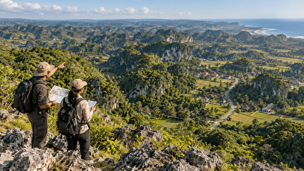
The limestone hills of Gunungkidul are often treated as a scenic backdrop for beaches, caves, viewpoints, and outdoor activities. That view misses an important point. The karst landscape is part of the natural system that makes the region distinctive, supplies ecological functions, and constrains what development can safely do.
Gunung Sewu UNESCO Global Geopark extends across Gunungkidul in the Special Region of Yogyakarta, Wonogiri in Central Java, and Pacitan in East Java. The Gunungkidul Regency government describes the wider geopark as approximately 1,802 square kilometers, with 33 geosites distributed across three geoareas. Those figures describe the broader geopark, not an area wholly contained in Gunungkidul. See the Regency government's overview of Gunungkidul (opens in a new tab) and the official Gunung Sewu geopark profile (opens in a new tab).
The policy question is therefore whether tourism development can use the landscape without undermining the ecological and geological features that give the destination long-term value. A single viewpoint or attraction drawing visitors does not answer it.
What makes karst different?
Karst landscapes develop mainly through the dissolution of soluble rock, especially limestone. Over time, water shapes surface formations such as limestone hills, sinkholes, dry valleys, and depressions. Below ground, it can form caves, conduits, and underground river systems. In Gunung Sewu, surface and underground features are connected parts of one geological system rather than separate attractions.
That connection matters for planning. In many karst settings, water can move rapidly through fractures and conduits, sometimes with less natural filtration than people might expect from a conventional soil-and-river landscape. Pollution entering a sinkhole, cave stream, or poorly managed drainage route may therefore travel through a pathway that is difficult to observe from the surface. The exact vulnerability varies by site, geology, land use, and flow conditions; it should be evaluated rather than assumed to be identical everywhere.
A 2016 hydrochemical study in Gunung Sewu found that water sources can respond rapidly to heavy rainfall, indicating fast conduit flow and short transit times in parts of the karst system. It also reported seasonal differences in measured water chemistry, including dissolved aluminum levels frequently above the Indonesian guideline value during rainy-season sampling. Those are historical study findings, not a statement about current water quality at every site, but they demonstrate why karst water needs local monitoring rather than assumptions based on appearance. Read the study in Applied Water Science (opens in a new tab).
The landscape also contains biological and cultural values. A 2026 case study published in the Gunungkidul Regency research journal examined the connections among geological heritage, biodiversity, and culture at selected sites including Pindul Cave, Telaga Ngepan, and traditional settlements. Its qualitative approach does not provide a district-wide quantitative index, but it supports a useful planning principle: these heritage dimensions are interconnected and can be damaged when managed as unrelated assets. The study is available through Jalin Ristek, the Regency's regional innovation journal (opens in a new tab).
What a geopark designation means
UNESCO describes Global Geoparks as unified areas where geological heritage is managed through protection, education, and sustainable development. Its framework also stresses local participation and the relationship between geological heritage and other natural and cultural assets. The designation does not mean that every site has identical legal protection, and it does not certify every proposed project as environmentally acceptable. See UNESCO's explanation of Global Geoparks (opens in a new tab).
For tourism operators, this means interpretation should explain why a formation matters instead of using it only as a photo setting. For planners, it means site-specific constraints need to be considered before roads, buildings, drainage systems, utilities, or visitor facilities are approved. For local communities, it means the value of the landscape should translate into fair opportunities, such as guiding, education, locally supplied services, and heritage-based enterprises, without transferring the cost of conservation to residents alone.
What the local environmental plan says
Gunungkidul's Regional Environmental Protection and Management Plan for 2025-2055, established through Regional Regulation No. 1 of 2025 (opens in a new tab), provides an official planning framework for environmental protection and management. The regulation's scope includes environmental carrying capacity and capacity to absorb pressures, environmental problems and targets, and directions for protection and management. The plan matters because it places environmental conditions in the formal planning process rather than leaving them solely to individual project decisions.
A long-term plan, however, is not the same as proof that each program has been funded, implemented, or achieved its intended result. That distinction should remain visible in public reporting. A monitoring system needs to show what changed, where, over what period, and whether a change can reasonably be connected to a particular intervention.
Economic value beyond ticket sales
Karst landscapes support several kinds of value that do not appear directly in attraction revenue. Geological heritage can support education and scientific study. Vegetation and soils can help moderate erosion. Water systems sustain households and economic activity, although availability and access vary across locations and seasons. Caves and other formations may also hold ecological, cultural, and archaeological significance.
These values should not be assigned invented monetary totals. A defensible economic assessment would first identify the specific ecosystem service, the people who depend on it, the spatial area involved, and the evidence needed to measure change. For instance, a water-security assessment needs data on seasonal flow, abstraction, quality, and access. The number of tourists or the size of a groundwater reserve estimate does not provide that.
Tourism can make conservation economically visible by supporting interpretive guiding, local enterprises, research partnerships, and visitor education. But tourism cannot be treated as the automatic solution to every conservation problem. More visitors can increase pressure on sanitation, water demand, roads, waste services, and sensitive sites unless management grows with demand.
A practical test for new development
Before supporting or opposing a proposed tourism project, ask five questions:
- What exactly is the site? Identify the geological formation, water pathways, habitats, land use, and any specific protection or planning designation that applies.
- What will physically change? Map excavation, land clearing, building footprints, drainage, wastewater, vehicle access, lighting, and visitor movement.
- What alternatives were compared? Examine whether a smaller footprint, a different location, an existing building, or a lower-impact visitor model could meet the same purpose.
- Who monitors the result? Name the responsible operator and public authority, the baseline indicators, the reporting schedule, and the consequences if standards are missed.
- Who benefits locally? Assess jobs, local procurement, community access, and who carries any restrictions or restoration costs.
These questions make the debate more useful than a broad argument that development is always progress or that every new building is necessarily destructive. The correct answer depends on the geology, design, scale, safeguards, and performance of the actual project.
What should be measured?
For karst landscapes, a compact monitoring program could track land-cover change, spring or cave-stream flow where relevant, groundwater quality at selected monitoring points, visible erosion, waste leakage, habitat condition, and the condition of geosites. Indicators should be selected with qualified technical input and adapted to each site; no single dashboard can represent every ecological function.
Publicly available data also needs to be transparent about what it cannot show. A map of vegetation cover can indicate where erosion risk may be higher, but it does not by itself establish that a specific project caused measured erosion. A count of visitors can show pressure on a site, but it does not reveal wastewater treatment performance or biodiversity change without additional data.
The bottom line
Gunung Sewu's karst is an irreplaceable foundation for tourism, local water systems, biodiversity, and cultural heritage. The strongest development strategy sits between freezing every landscape in place and treating its scenery as an unlimited commercial resource. It sets site-specific limits, uses evidence before approvals, makes monitoring public, and shares the benefits of conservation with the communities whose lives are connected to the landscape.
Sources consulted
- Government of Gunungkidul. “Gambaran Umum” [General Overview]. Publication date not stated; checked 25 October 2026. https://gunungkidulkab.go.id/gambaran-umum/ (opens in a new tab)
- Global Geoparks Network. “Gunung Sewu UNESCO Global Geopark.” Publication date not stated; checked 25 October 2026. https://www.globalgeopark.org/GeoparkMap/geoparks/Indonesia/12540.html (opens in a new tab)
- UNESCO. “UNESCO Global Geoparks.” Page updated 20 August 2026; checked 25 October 2026. https://www.unesco.org/en/iggp/geoparks/about (opens in a new tab)
- Government of Gunungkidul. Regional Regulation No. 1 of 2025 on the Regional Environmental Protection and Management Plan for 2025-2055. Enacted 15 July 2025; checked 25 October 2026. https://peraturan.bpk.go.id/Details/330388 (opens in a new tab)
- Eiche, E., Hochschild, M., Haryono, E., et al. “Characterization of recharge and flow behaviour of different water sources in Gunung Kidul and its impact on water quality based on hydrochemical and physico-chemical monitoring.” Applied Water Science, published 10 June 2016; checked 25 October 2026. https://link.springer.com/article/10.1007/s13201-016-0426-z (opens in a new tab)
- Srilestari, E. “GEO-BIO-CULTURAL: TRILOGI WARISAN GUNUNG SEWU UNESCO GLOBAL GEOPARK DI GUNUNGKIDUL” [Geo-Bio-Cultural: The Heritage Trilogy of Gunung Sewu UNESCO Global Geopark in Gunungkidul]. Jalin Ristek, published 21 May 2026; checked 25 October 2026. https://jurnal.gunungkidulkab.go.id/index.php/jr/article/view/23 (opens in a new tab)
Keep reading
This article is part 1 of 12 in the series "Conservation, Environment and the Tourism Trade-off".