Nglanggeran Ancient Volcano: A Thoughtful First Visit
Nglanggeran is more than a viewpoint in Gunungkidul. This first-visit guide explains how to read its geological and community context, plan carefully, and travel with respect.
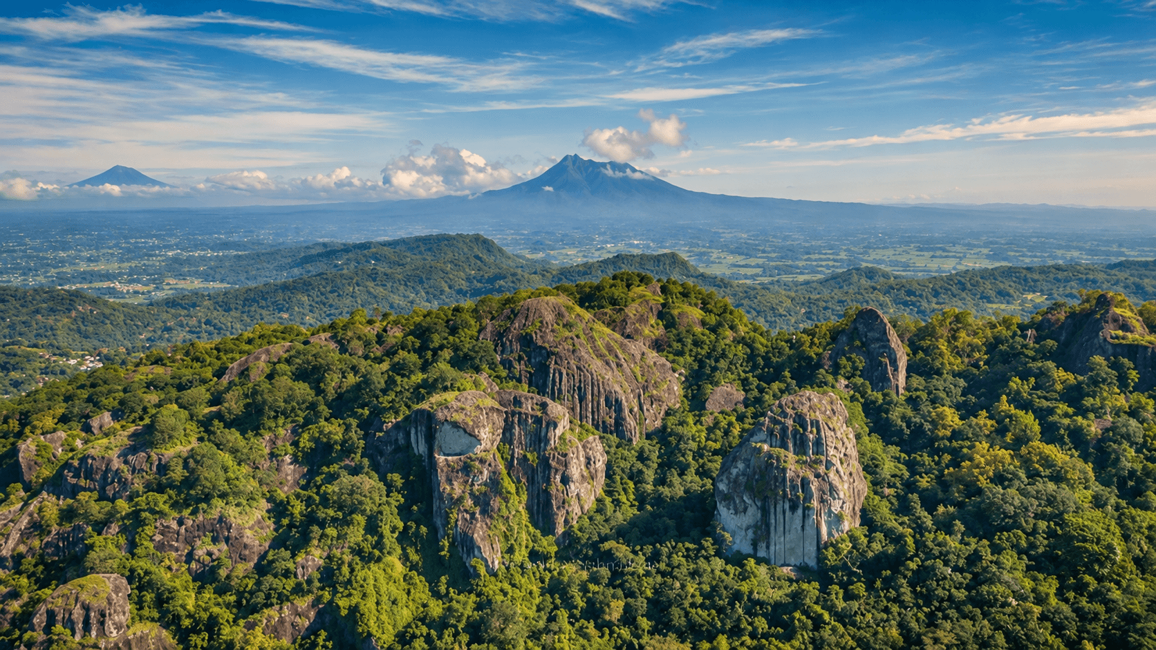
Nglanggeran Is More Than a Viewpoint
Nglanggeran is often introduced through its dramatic rock formations and wide views across northern Gunungkidul. That is a fair starting point, but it is not the whole place. A better first visit begins by treating the landscape as a geological site and the village as a living community, rather than as a quick stop for a photograph.
The official Gunungkidul tourism office identifies Nglanggeran as a geoheritage site and the type locality for the Nglanggeran Formation. Its rock record includes volcanic breccia, agglomerate, and andesitic-basaltic lava that were later fractured, faulted, and eroded into the blocky hills visible today. Read the Gunungkidul tourism office's geosite description (opens in a new tab).
That context changes the experience. The large boulders are not simply a dramatic backdrop; they are part of the reason the place matters. Slow down, keep to designated routes, and avoid treating narrow passages or rock surfaces as props.
A Tourism Village, Not an Isolated Attraction
Nglanggeran is in Patuk District, Gunungkidul Regency, within the Special Region of Yogyakarta. The Yogyakarta Tourism Portal describes the village as being about 25 kilometers from Yogyakarta and notes the Ancient Volcano and Nglanggeran Reservoir among its natural attractions. See the portal's destination overview (opens in a new tab).
Its wider tourism story is as important as its landscape. Nglanggeran received recognition in the 2021 Best Tourism Villages program, and its UN Tourism profile describes a community-based approach that connects tourism with local livelihoods, including farming, crafts, and cacao-related activities. Read the UN Tourism profile (opens in a new tab).
For visitors, this is a useful cue: a visit can be more meaningful when it leaves room for locally managed activities and locally made products, rather than treating the village as a single hike between two larger destinations.
Plan Around Conditions, Not Assumptions
Nglanggeran is a natural area with uneven terrain, exposed sections, and weather-dependent views. The practical details that matter most—current opening arrangements, entry procedures, route conditions, weather restrictions, and the availability of local activities—can change. Confirm them directly with the official or local manager before departing.
This is especially important if your plan depends on a sunrise, sunset, camping, a guided activity, or a tight transportation schedule. Do not rely on an old blog post, an undated social-media upload, or a search-result snippet for operational information.
Bring water, wear footwear suited to uneven ground, and give yourself enough daylight to complete the route without rushing. If rain, wind, or reduced visibility changes the conditions, revise the plan rather than forcing the itinerary.
Let the Visit Support the Place
Responsible travel here is not complicated, but it is deliberate:
- Follow local instructions and stay on the permitted path.
- Keep noise low near homes, farms, and shared spaces.
- Carry out all waste, including food packaging and cigarette filters.
- Ask before photographing people, private activities, or culturally sensitive moments.
- Choose services and purchases with a clear local connection when they fit your plans.
These habits do not make a visit less spontaneous. They make it more attentive to the people and landscape that sustain the destination.
A Better Way to Remember Nglanggeran
The strongest memory of Nglanggeran may not be a single panorama. It may be the contrast between ancient volcanic material, cultivated land, and a village that has built tourism around local participation. Seeing those layers together gives the destination more depth than a checklist of viewpoints ever could.
Before publishing or traveling, re-check practical visitor information directly with the manager. The geological source linked above was published in 2022; its description is useful context, but any operational information should be treated as time-sensitive.
Sources Consulted
- Gunungkidul Tourism Office, "Geosite Nglanggeran" (opens in a new tab), published December 27, 2022; accessed October 25, 2026.
- Yogyakarta Tourism Portal, "Nglanggeran Tourism Village, Gunungkidul" (opens in a new tab); accessed October 25, 2026.
- UN Tourism, "Nglanggeran" (opens in a new tab); accessed October 25, 2026.